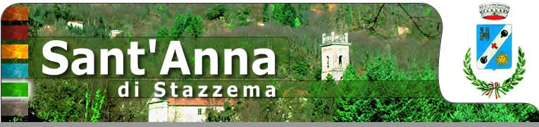
THE VILLAGE - domenica 12 maggio 2024
Sei in: »Portale di Sant'Anna di Stazzema »IL PAESE »THE VILLAGE
HOW TO GET THERE
- 17/01/2006 10:06:17
How to get there
How to get to SantAnna di Stazzema
LINKS
- Tuscany Region
Official site of Tuscany Region - Municipality of Stazzema
Web site of Municipality of Stazzema
[TERRITORY]
The area of Stazzema
The Municipality of Stazzema and its hamlets.
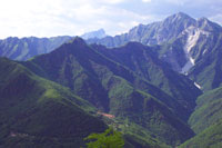
Stazzema is the smallest municipality of the Versilian area. It is also the highest above the sea level (443 meters). The homonym village, Stazzema, is placed on the slopes of the Matanna mountain.The area of the whole municipality is enclosed to Northeast and Northwest by the Apuan Alps, to Southwest by the municipalities of Camaiore and Pietrasanta and to West by the one of Seravezza, from which it is far 12 kilometers. From the village of Stazzema starts a net of paths allowing to reach every places and peaks of the Apuan Alps. The town hall centre is situated in the village of Ponte Stazzemese.
In the village of Stazzema live about 600 people; few commercial and tourist activities and artisan laboratories constituted its economy.
The Municipality of Stazzema is divided by 18 hamlets, each one having its own history and traditions.
The hamlets are the villages of: Stazzema, Cardoso, Levigliani, Arni, Terrinca, Pontestazzemese, Farnocchia, Sant’Anna, Pomezzana, Retignano, Pruno, Volegno, Ruosina, Palagnana, Mulina, Gallena, La Culla and Campagrina.
Cardoso - mt. 265
It’s far about 3 Kms from Pontestazzemese. It can be reached following the course of the Vezza river. The village was constituted in 1407 through the merger of 3 hamlets: Cardoso, Malinventre and Farneta.
The main economic activity is the mining and the workmanship of a typical local stone called "Pietra del Cardoso", which was known since the X century; it is used to manufacture the door-posts and window-posts, the thresholds, stairs and more. The church of the village, devoted to S. Maria Assunta, was built in the first halves of 1700 and it is placed in front of the beautiful bell tower built in 1745.
www.il-cardoso.it
Levigliani - mt. 650
It had ancient origins, as numerous etruscan archaeological finds and the necropolis of the Ligurian-Apuan population testify. In a first time it was joined with the hamlet of Terrinca, then, it acquired autonomy in the first decade of 1500. Levigliani has excellent climatic conditions and holds a big tourist importance: beside to be a summer holidays’ place, it is one of the main departure’s point to pleasant walks, binding alpine itineraries and to visit the famous "Antro del Corchia", which is the calcareous cavern of the Corchia mountain having an exceptional scientific interest and a spectacular wonder. The village’s main economic activity is the traditional mining of the marble.
www.levigliani.it
Arni - mt. 916
Arni is a small village 916 meters high above the sea level, placed beyond the Altissimo mountain. It’s separate, from Massa city and from the Versilia’s area, by the Cipollaio hill and the Vestito passage. The Arni’s valley extends it through about 3 Kms including wide pastures, beech woods, chestnut woods and good wellsprings.
At once, from Arni started the railroad carrying the marble’s blocks to the lowland’s harbors. The village is surrounded by mountains plentiful of silver plumb, pyrites copper, navacolite, calcium, dolemite and white marbles. Mr. Saucholle Henruaux, in 1849, started to extract the marble from these mountains. Sella, Vestito, Altissimo, Cipollaio, Corchia and Frèddone are the mountains encircling the village. The Arni’s valley is the geographical crossroad among the areas of Versilia, Garfagnana and the city of Massa.
Terrinca - mt 500
It’s a small village placed in the bottom of Corchia mountain, among woods of chestnut tree. It’s the eldest village of the Versilia’s area: it was dominated by the Longobarda people since 766 AD, then it became autonomous municipality (1376) and, at last, hamlet of the Municipality of Stazzema. Worthy to visit the church having rich marble’s ornates, numerous coats of arms and portals belonged to Medici, headstones and marmoreal reliefs of various Romanesque epoches. Numerous and interesting excursions can be effected: Passo Croce, the peat-bog of Paduli, Puntato and Pania della Croce, Campanice, Corchia, Col di Favilla mountains etc. Soon, in the area of the village, will be prepared a museum of "Sacred Art en plain aire" and "Rocky Engraving" of which the surrounding territory is rich.
www.terrinca.it
Pontestazzemese - mt. 160
Height m. 160
Reascend the valley of the Vezza stream, at the confluence of the Mulina stream into the Versilia river, is placed the village of Pontestazzemese, which is the administrative center of the Municipality of Stazzema. On its background there is the characteristic Forato Mountain (1223 ms.), on the left the Pania della Croce mountain (1859 ms).
The Church, preserving a valuable chasuble of the XV century, is devoted to S. Antonio da Padova, which is celebrated every year on June13rd.
As the village is placed into a valley along a river, its climate is fresh during the summer, therefore it’s proper for the holiday; instead, during the winter it’s cold and damp.
The main resource of the village’s economy is the marble.
As the village of Cardoso also Pontestazzemese have heavily been damaged by the flood of June 1996.
Farnocchia - mt 650
The origins of Farnocchia goes back to the fore-roman Liguri Apuani’s age. It’s placed in the middle of wide chestnut’s woods and it’s destination of many tourists and holidayers. Its position offers a wonderful view on the most beautiful mountains of the Apuan Alps as: Matanna, Procinto, Forato, Pania Secca, Pania della Croce and Corchia, instead, Gabberi mountain can be reached in a short wile and, from its position, the coastal band going from La Spezia’s gulf to Livorno’s city can be seen.
The building of the church, devoted to S. Michele Archangel, goes back to before the XI century. In its interior an ancient baptismal font, a big organ, the Rosary’s altar having wonderful bas-relief tiles representing the 15 rosary’s stops. During the summer, in the village gastronomic feasts and culinary demonstrations are organized.
Pruno - mt. 468
Pruno is a beautiful village of the high Versilia; it’s a hamlet of the Stazzema’s municipality. It’s dominated by the Pania della Croce, Procinto and Forato huge mountains and its position is the best to observe a suggestive natural phenomenon: the passage of the sun through the Forato mountain hole, on the summer solstice dawn.
The village maintains a medieval urban plant, made by narrow lanes surrounding the central tower, along which, every Christmas, the whole community organize a living Manger.
The village still keep alive an ancient theatrical tradition which, from the past, have characterized the main bank holidays as the "befanata", on January 6th, which is prepared and sung along the lanes and plazas of Pruno and Volegno’s villages; in the summer there are prose and poetry, concerts and dance performances besides the traditional religious ceremonies.
Departing from the village is possible to effect excursions to Apuan Alps and to visit the livestock’s summer pasture places of Caselle, Pereta, Rocchetta, Poggiogo testifying this ancient activity not yet extinct.
Volegno - mt. 438
The village’s church rises above the ancient oratory (XVI century) devoted to Madonna delle Grazie; its bell tower was built in 1888 in new-Gothic style. The village’s traditional religious bank holidays are St. Sebastiano (4th Sunday of August), the Patron St. Niccolò (6th of December) and S. Maria delle Grazie (8th of September).
Pomezzana - mt. 600
The village, surrounded by chestnut’s woods, rises on the slopes of the Matanna mountain, near of "Castellina" hill, which is a suggestive point of views of the Apuan Alps and the Municipality of Stazzema’s villages.
The village, today, has about 300 citizens and its economy, having ancient traditions, is primarily handicraft, especially the activity of the iron workmanship to create agricultural tools. The Parish Church, devoted to S. Sisto, preserve sacred artworks and valuable furnish (a parish cross made by Lucca’s manufacturer in 1200 and an altarpiece made in 1400 ).
Pomezzana is an important point of departure for excursions to Procinto, Gabberi and Matanna mountains.
Palagnana - mt. 790
The village is situated in the bottom of the Cross (1314 ms.) and the Matanna mountains (1317 ms.). It was, at first, the livestock’s summer pasture place of the village of Stazzema. Placed along the ridge of the mountain, toward the Turrite stream, it’s completely surrounded by chestnut and beech’s woods. The main economic activities are the agriculture and the sheep-rearing.
From the village, going through ancient paths, the village of Fornovolasco (with the famous Grotta del Vento rich in stalactites and stalagmites) or the Cross or the Matanna mountains can be reached.
Retignano - mt. 440 -
Surrounded by chestnut woods, it rose in the XVI century as Roman village; in the XII century it became autonomous municipality and it was extended up to the villages of Stazzema, Ruosina, Gallena, and Argentiera.
The Church, devoted to S. Pietro Apostolo, was built in the VIII century; it contains valuable artworks, precious carvings and Renaissance sculptures, precious sacred furnish (a devotional cross in silver manufactured in 1400; a holy water stoup manufactured in 1500; a beautiful baptistery with a valuable baptismal source).
Every three years it is possible to admire, on Holy Friday’s day, the traditional illumination of "Jesus Morto."
Ruosina - mt. 102
It’s the hamlet of the Municipality of Stazzema nearest to the coast. Ruosina is situated in a green and deep valley of the high Versilia.
In the XVII and XVIII centuries, Ruosina was the main center of the iron’s workmanship, because it was the abode of the Regal Magona medicea, as old marble coats of arms, setted on some local walls, testifies.
From the end of 1700 and for almost the wole 1800, the village has been the Municipality of Stazzema’s most important center: it was Municipality Center, besides to be center of the first Postal Office. In 1883 the Municipality Center was moved to Pontestazzemese and Ruosina began to decay.
La Culla - mt. 450
The village is placed 6 Km after the village of Monteggiori, along the street leading to Sant’Anna di Stazzema. La Culla is a delicious village, situated on a steep slant of the Gabberi mountain’s southern layers, and it’s completely surrounded by olive-grove.
The nearness of the sea makes the climate fresh and ventilated, suitable for good holidays.